
Kenmore ZIP Directory Coverage
ZIP 98028 is the primary postal code associated with Kenmore. The nearby 98011 Bothell and 98034 Kirkland areas appear beside it on King County's regional ZIP map and in Census crosswalks. Those regional links do not make every address in all three ZIP areas part of Kenmore. An exact address needs two checks: USPS for its delivery label and the county parcel viewer for its incorporated jurisdiction.
| ZIP Code | Areas Covered | Post Office | Notes |
|---|---|---|---|
| 98028 | Primary Kenmore postal area | Kenmore Post Office | Confirm city jurisdiction parcel by parcel |
| 98011 | Adjacent Bothell-area geography | Verify through USPS | Regional and Census crosswalk context |
| 98034 | Adjacent Kirkland-area geography | Verify through USPS | Do not relabel as Kenmore without GIS proof |
No official source reviewed identified a Kenmore-only ZIP split, special institutional ZIP, or PO-box-only neighborhood code. That absence matters. It keeps the Kenmore ZIP code directory grounded in verified delivery facts instead of turning nearby map labels into city claims. The county map is dated January 2013, so use it for orientation, not as a current delivery guarantee.
98028 at Kenmore Post Office
The official USPS location record places the Kenmore Post Office at 6700 NE 181st St, Kenmore, WA 98028-9998. The station page listed weekday retail windows from 9:00 a.m. to 1:00 p.m. and 2:00 to 5:00 p.m., with weekend closure, plus 425-482-9755. Hours can change, so check the location page before a visit.
The station's ZIP+4 identifies its own delivery segment. It does not say that every person using the station lives there, and it does not define the city border. Treat the post office as a postal access point, not as a resident roll.
Verify a Kenmore ZIP Address
The USPS ZIP Code Lookup offers three useful routes: code by address, code by city and state, and cities recognized for a code. Address mode is the sharpest choice because it can preserve the full street line and return ZIP+4 when available.
| Lookup mode | Fields to enter | Best use |
|---|---|---|
| ZIP by address | Company optional; street, city, state required; unit and ZIP optional | Verify one delivery address |
| ZIP by city/state | City and state | Find codes USPS associates with a place name |
| Cities by ZIP | ZIP | See recognized postal city labels |
The captured lookup shows those official modes clearly. It also warns against a common myth: a successful address result does not verify that a named person or business exists there.
Open the USPS lookup screen before entering a current street address.
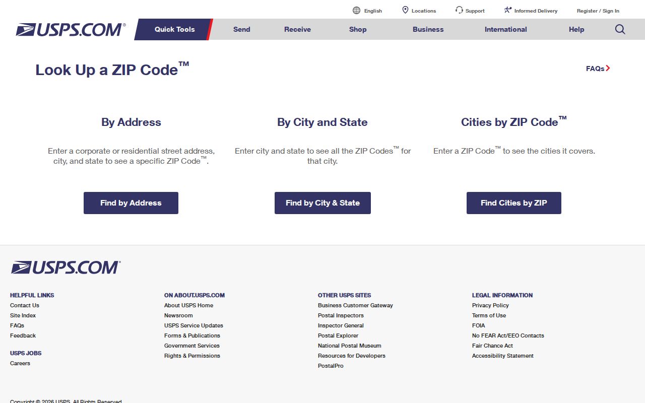
The three choices separate address verification from broader city and ZIP exploration, which prevents a postal result from being stretched into proof of residency.
Find Kenmore Residents by ZIP
No inspected county portal supplies a public, ZIP-wide list of people. The useful path is narrower and more reliable: confirm the postal code, identify the parcel, and then consult the official record keyed to that parcel or a known name. This keeps the word resident from being confused with owner, taxpayer, voter, or recipient of tax mail.
- Enter the full street address in USPS and save the returned city, state, ZIP, ZIP+4, and search date.
- Open King County Parcel Viewer, select Kenmore when useful, locate the parcel, and record the situs address and jurisdiction.
- Follow the selected parcel to eReal Property. Keep owner or taxpayer, mailing address, and physical situs as distinct fields.
- For a lawful election-data question, ask King County Elections what aggregate or public fields can be supplied for the stated area.
- Once the work reaches one road, follow the Kenmore directory by street for the address-level record chain.
VoteWA cannot browse everyone in 98028. Its public match form needs a first name, last name, date of birth, and CAPTCHA. Public voter data has statutory limits, while protected address-program participants receive added safeguards. Use a ZIP only to narrow geography, never to defeat those protections.
Kenmore ZIP Meets Parcel Data
King County eReal Property is built around a parcel or account, not a ZIP-wide person search. The related eMap accepts a ten-digit parcel or a Public Land Survey System search using quarter, section, township, and range. Optional fields include a four-digit city levy code and map update dates. Parcel Viewer adds an address box, city selector, street and cross-street controls, selection tools, layers, and a buffer distance.
| Field | Format | What it settles |
|---|---|---|
| Parcel | Ten digits, no spaces or hyphens | Direct property key |
| Quarter, section, township, range | PLSS selectors | Legal map area |
| City levy code | Four digits | Tax-area filtering |
| City and street | Viewer controls | Map and parcel selection |
A selected parcel can link to the assessor report and a Districts & Development Conditions report. Neither report is a household list. The owner mailing address may differ from the situs, and that difference must remain visible in any notes.
No Kenmore Voter ZIP List
Washington law allows public inspection and copying of parts of the voter-registration record under RCW 29A.08.720, but the public VoteWA screen is still a one-person match tool. It does not expose a public browse of a street or ZIP code directory. Full dates of birth, driver-license details, Social Security information, and other private fields are withheld.
King County Elections accepts a public-disclosure request with requester contact details, a clear description, date range, jurisdiction, and preferred delivery method. Ask what aggregate or releasable fields fit a ZIP-level question. The office may seek clarification, and the use restrictions continue to apply after release.
Key distinction. A postal label, tax mailing address, or voter match does not prove that a person occupies a Kenmore home.
Older Kenmore Address Labels
ZIP codes are younger than much of Kenmore's property trail. For older research, a current code can be a poor starting key. King County's 1937-1972 assessor cards preserve location, parcel, house number, street, addition, former building number, former street, former address, and notes. Plats, newspapers, and post-office references can bridge the years before modern postal conventions.
Kenmore became an incorporated city in 1998, although the local place name and post office date much earlier. Search terms such as Northlake Terrace, Uplake Terrace, the Sammamish River, or a plat name may find a record that never used the current city label. Record the name exactly as the source gives it.
Kenmore ZIP Lines and Limits
Postal geography, city jurisdiction, county districts, and Census areas answer different questions. King County Public Health warns that city boundaries do not line up with ZIP-based regions. Its North Region groups several cities, while a Census ZIP Code Tabulation Area is a statistical geography rather than a delivery rule. For a delivery label use USPS; for legal city location use the county GIS jurisdiction field; for population tables use the clearly labeled Census geography.
- ZIP and ZIP+4
- The five-digit delivery area and its added four-digit delivery segment.
- Postal city
- A city label USPS recognizes for delivery; it may differ from the incorporated jurisdiction.
- Situs address
- The physical property location used by county assessor and GIS records.
- Carrier route
- A USPS delivery path, not a municipal boundary or public resident list.
The Kenmore ZIP code directory works best as a cross-check. Preserve each system's label, date the lookup, and do not merge postal, legal, and statistical areas into one claim.