
Kenmore Neighbors by Record
A block lookup works best as a set of labeled observations. The King County Parcel Viewer fixes the starting address on a map and exposes nearby parcel boundaries. Its selected-parcel links lead to the assessor report and a Districts & Development Conditions report. The assessor identifies an owner or taxpayer, not every person who sleeps at the address. Recorder, permit, voter, and association sources answer still different questions.
| Source | What It Shows About a Block | Access |
|---|---|---|
| King County Parcel Viewer | Parcel edges, situs context, selected-parcel links, nearby lots | Free online map |
| eReal Property | Owner or taxpayer, mailing and situs fields, parcel facts | Free online report |
| Landmark Web and Archives | Recorded deeds and other instruments tied to parcel or legal description | Online after July 1991; Archives for earlier records |
| VoteWA and Elections | A match for a known voter; approved public list fields by request | Name/DOB form or formal request |
| Local organizations | Public history, meetings, newsletters, plat and civic contacts | Public pages or direct inquiry |
Write down the source date and the exact role beside each name. An owner may live elsewhere. A taxpayer mailing address can differ from the situs, meaning the physical location of the property. A permit applicant may be a designer, contractor, or agent. A voter result confirms only the match presented by that system. These limits are useful, not frustrating: they stop a plausible guess from turning into a false claim about Kenmore neighbors.
Select a Kenmore Block
The county map supports address, parcel, street, intersection, place, and landmark searches. Start with the full address. If it fails, try the street and cross street, then verify the city or jurisdiction shown for the parcel. The map's New selection and Add to selection controls let a researcher build a small set instead of sweeping an entire road.
Turn on only the layers needed for the question. Parcels establish lot lines; aerials help explain access and structures; district and zoning layers add civic context. A buffer can define a consistent radius when that control is available. Corner lots and parcels that extend behind a second frontage deserve special care because map proximity does not prove two addresses share a household.
- Situs address
- The physical property location.
- Mailing address
- Where tax or owner correspondence goes.
- Parcel number
- The county identifier that links map, assessor, and recorded-document research.
- Legal description
- The plat, lot, block, or survey language used in title records.
Map Kenmore Parcels Outward
Keep the scope tight: the subject parcel, the lots touching it, and the parcels directly across the road. That is the immediate block around one address. Use the same order for every parcel so results remain comparable.
- Find the address in Parcel Viewer and save its parcel number, situs, city field, and legal description.
- Choose Add to selection, then select each adjoining and facing parcel. Note cross streets and corner frontage.
- Open each linked eReal Property report. Record owner/taxpayer and mailing address as separate fields.
- Compare the mailing and situs fields. A match can suggest owner occupancy, but it does not establish everyone present.
- Expand to a whole road only when needed; the Kenmore street directory owns that larger search.
The result is a parcel worksheet rather than a list of people. Include a column for date checked. Property transfers, mapping changes, and mailing destinations can change, so a saved result without its source date is weak evidence.
Kenmore Deeds and Projects
Once nearby parcel numbers are known, King County Landmark Web can connect them to recorded instruments. A deed uses grantor for the party giving an interest and grantee for the party receiving it. Those roles document a transaction, not present-day residence. Search by parcel or legal description when a street address produces little.
The online and archival paths split at August 1, 1991. For an older instrument, use the King County Archives copy route, its microfilm holdings, or a scheduled research-room visit. Later copies can be requested online, by mail, phone, or in person from the Recorder. Certification comes from the custodian, not a browser image.
Current construction context comes from MyBuildingPermit. Search by jurisdiction and address or parcel, then keep project location, applicant, contractor, permit type, and status distinct. A nearby permit may explain activity on the block without identifying who resides there.
Note: Parcel and legal-description searches often succeed when a Kenmore street label has changed or was entered inconsistently.
Uplake's Kenmore Block Story
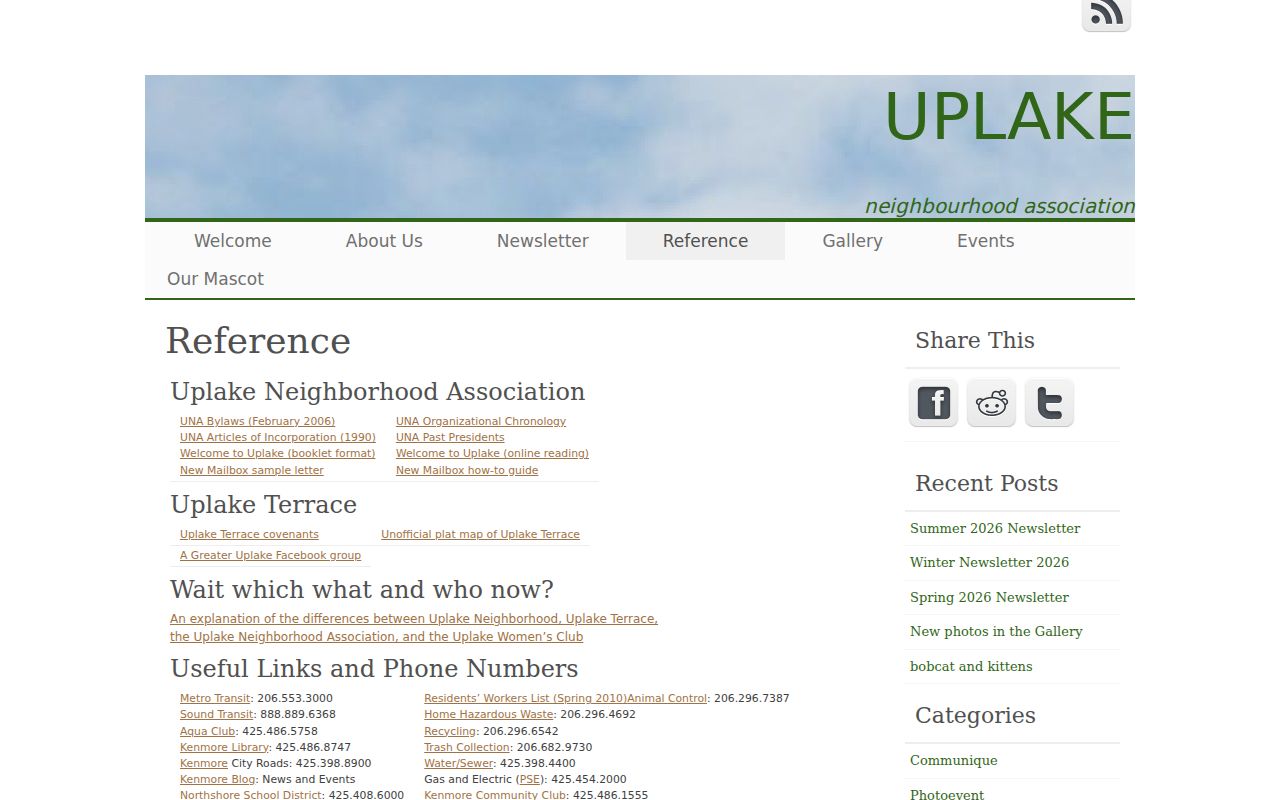
Uplake Terrace gives block research a rare local history layer. The Uplake Neighborhood Association resources describe roughly 500 homes, with much of the area developed in the mid-to-late 1950s and construction beginning around 1953. The association was chartered in 1956. Its public resources include bylaws, articles, a plat map, restrictive covenants, an organization timeline, and newsletters.
View the Uplake public resource page before using the association layer.
A February 2026 city preservation project adds another layer: 102 properties were documented or updated in WISAARD, including 80 in Uplake Terrace, with photographs, a master map, and individual files. Use that survey to recognize architecture and historic context, then verify ownership and parcel facts in county systems.
Kenmore Community Contacts
Community groups can explain a neighborhood's boundaries, events, and shared history. They are voluntary organizations, not official resident rolls. Neither of the named groups below publishes a complete public member directory.
Uplake Neighborhood Association
Public plat, covenants, chronology, newsletters, meetings, and association history. Membership is voluntary.
Visit UplakeKenmore Community Club
Independent secular volunteer group with civic programs. Its contact form accepts a name, email, phone, and inquiry type.
Visit the clubOther public civic routes named by the City include the Bothell Kenmore Chamber, Northshore Senior Center, Kenmore Waterfront Activities Center, Kenmore Community Rowing Club, Northshore Utility District, and Northshore School District. Contact a group about its own activities or records. Do not ask it to disclose private membership information.
Kenmore Voters on a Block
VoteWA is a match tool for a known person. It asks for first name, last name, date of birth, and CAPTCHA; it is not a public street browser. A broader voter-file request goes through King County Elections or the Washington Secretary of State and remains subject to RCW 29A.08.720.
Public data can include a name, address, year of birth, and voting history. Full birth dates, driver's-license information, Social Security data, and protected fields stay private. State action in 2025 and 2026, including SB 5892, reinforced the public/private split and centralized statewide database requests. Never treat a voter match as proof that all people at the address are visible.
If the online form is unavailable, contact King County Elections by phone, email, mail, or in person and ask what public record can lawfully be supplied. Statewide requests follow the Secretary of State route. Preserve the request scope and custodian response.
Official Versus Commercial Lookups
Official sources are narrower, but their labels and custodians are clear. Commercial neighbor tools may merge old addresses, public filings, and other data without showing why a name was attached to a place.
| Route | Strength | Main limit |
|---|---|---|
| County and state records | Named custodian, source date, defined field | No complete household list |
| Community organizations | Local history and direct civic contact | Voluntary and no public roster |
| Commercial category | May gather leads quickly | Stale merges, unclear provenance, cost, and opt-out issues |
Use a commercial result, if encountered, only as a lead. Confirm the underlying fact at the assessor, recorder, election office, court, library, or other named custodian. Removing a result from a private service does not erase an official public record.
Limits on Kenmore Neighbor Records
No official Kenmore source provides every occupant, renter, child, household member, utility customer, or delivery recipient on a block. Driver and motor-vehicle address data are restricted. Court-sealed records, vital records, and protected voter fields follow their own rules. Washington's Address Confidentiality Program under chapter 40.24 RCW provides eligible participants a substitute address and protected record handling; it is not a general public lookup.
The safest worksheet stores the minimum needed: parcel number, public role, source, date, and a short reason for the search. Do not republish sensitive fields or infer relationships between nearby people. If an official field is wrong, contact its custodian. For a city record, the Kenmore City Clerk is the route; for parcel data, contact the King County Assessor; for a recorded instrument, contact the Recorder or Archives.
Lawful use. Research Kenmore neighbors only for lawful personal, family-history, civic, or safety purposes. Never use a record to watch, confront, threaten, stalk, harass, or intimidate anyone.